


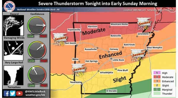
The Twin Lakes Area experienced a night of severe weather, and more may be on the way Saturday night.
According to the National Weather Service, a couple of areas in Baxter County were hit hard. There were reports around three a.m. of tree limbs down and shingles blown off a roof at Fawn Park, and ping pong ball size hail was spotted along with 40-to-50 mile per hour wind gusts at Mallard Point.
A trained weather spotter reported nickel size hail in Marion County three miles east of Lead Hill for nearly four minutes, and more nickel size hail was reported in Fulton County southeast of Gepp for nearly 15 minutes. Two-inch sized hail was spotted in Boone County east of Omaha.
The severe activity may not be over yet, according to Meteorologist Chuck Rickard of the National Weather Service office in North Little Rock.
Listen:
right-click to download mp3
For more information, go to ktlo.com/weather.
WebReadyTM Powered by WireReady® NSI