


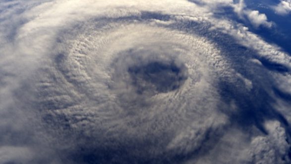
 iStock/Thinkstock(CORPUS CHRISTI, Texas) — The Texas coast is bracing for impact on Friday as Hurricane Harvey bears down on its shore. The storm, forecast to be a Category 3 hurricane by the time it makes landfall, is expected to be the worst to hit the state in nearly two decades.
Here’s a look at the latest radar of Hurricane #Harvey as it approaches the Texas Coast! #txwx #stxwx #ccwx pic.twitter.com/Jyz216q6Pc
— NWS Corpus Christi (@NWSCorpus) August 25, 2017
Here’s a look at what we know about the storm:
The weather details
The latest update from the National Weather Service (NWS), at 5 a.m. ET, showed winds at a sustained maximum of 105 mph. The storm was located 180 southeast of Corpus Christi at that time and was still being predicted to hit the Texas coast around midnight on Friday.
The NWS predicted winds of about 120 mph were likely when the storm comes ashore.
One of the biggest concerns with the storm is rainfall totals, as Harvey is likely to stall over Texas for days. As much as 35 inches of rain were possible in isolated areas, but 15 to 20 inches of rain are likely.
Storm surge is also expected to be a problem, with 6 to 12 feet possible from Padre Island National Seashore to Sargent, located about 75 miles south of Houston. Waves will likely be over 20 feet as well.
The preparation
Storm preparation began in earnest on Wednesday and intensified on Thursday. Shoppers lined up to fill their carts with food and water, while lines for gas stretched out of the parking lot.
Many people also got to work boarding up homes and businesses to protect against the 100-plus mph winds expected. Even the Texas Department of Transportation in Victoria boarded up windows on Thursday.
Most of the flights in and out of Corpus Christi International Airport for Friday have been canceled, according to FlightAware.
The Coast Guard said it is sending shallow-depth boats to the region in order to be ready for any necessary urban rescues. The Coast Guard has also ordered a nearly total closure of ports in the region, upgrading the alert status to one shy of its most critical.
The state announced mandatory evacuations for seven counties: Calhoun County, San Patricio County, Refugio County, Brazoria County, Jackson County, Victoria County and Matagorda County. While a mandatory evacuation order has not been ordered for Corpus Christi, Mayor Joe McComb did advise a voluntary evacuation.
Storm preparations have extended to New Orleans, where the Federal Emergency Management Agency said they are working to make sure pumps are working in anticipation of 7 to 10 inches of rain. The National Guard is also readying 500,000 sandbags, FEMA said.
How officials are responding
Politicians and officials have taken an expectedly proactive approach to the storm.
Texas Gov. Greg Abbott said Thursday evening that he had spoken to President Donald Trump, as well as the heads of Homeland Security and FEMA, about storm preparation.
Many officials urged residents to pay attention to evacuation orders, as it will be too late once the storm hits.
Texas hurricane history
The storm is already being compared to Hurricane Bret, which struck Texas on Aug. 22, 1999. That storm made landfall in Kenedy County, just south of Corpus Christi, according to the NWS — a track similar to the one forecast for Harvey. However, the maximum wind speeds of Bret were at 140 mph at the time of landfall, making it a Category 4 storm.
Here’s a look at some of the recent hurricanes to hit Texas and the damage they caused:
Hurricane Bret (Aug. 22, 1999) — The Category 4 storm made landfall on a Sunday evening about 60 miles south of Corpus Christi. Luckily, the area is sparsely populated compared to Corpus Christi, so problems were limited. Central Kenedy County received more than 15 inches of rain over two days, according to the NWS. The storm did about $88 million in damages in 2017 figures. Four Americans died in the storm.
Hurricane Claudette (July 15, 2003) — While Claudette came ashore as only a Category 1 storm, with max winds of 90 mph, it did extensive damage after coming ashore at Port O’Connor, about 100 miles northeast of Corpus Christi, and moving inland across Calhoun County, according to the NWS. Two people were killed.
Hurricane Rita (Sept. 24, 2005) — The last Category 3 storm to make landfall in Texas was Rita, though it did so much farther north than Harvey is expected to land. Rita, which hit just three weeks after Hurricane Katrina, made landfall right along the Texas-Louisiana border with sustained winds of 120 mph. The town of Center, Texas — near Nacogdoches — received 10.48 inches of rain in the storm, but it moved quickly through the area, limiting the rainfall amounts. Still, 59 people from Texas were killed in the storm, according to the NWS. A number of others died in a bus accident during evacuations.
Hurricane Ike (Sept. 13, 2008) — Ike, the last hurricane to make landfall in Texas, hit near Galveston as a Category 2 storm after decimating areas of the Caribbean in the week prior with winds as high as 145 mph. By the time it hit Galveston, winds were at a sustained maximum of 110 mph, according to the NWS. The massive size of Ike resulted in massive rainfall totals for the area. The highest total was 18.9 inches near Spring Creek, south of Houston, according to the NWS. Some sensors measuring storm surge actually failed due to salt water, according to a NOAA report, but the highest total was 17 1/2 feet in Chambers County.
Copyright © 2017, ABC Radio. All rights reserved.