


 ABC News(NEW YORK) — A slow-moving storm system drenched Texas overnight with some areas getting as much as a half a foot of rain and causing flooding, stranded cars and water rescues.
Also, this storm system produced damaging winds of close to 70 mph from Abilene to Fort Worth, and tennis ball-sized hail in western Texas from Midland to Abilene.
A line of strong to severe storms was moving through central Texas on Wednesday morning, with flash flood watches issued for the area.
As this storm system slowly moves east on Wednesday, the severe weather threat will shift south and east into San Antonio, Houston and even eastern Louisiana.
The biggest threat on Wednesday will be damaging winds close to 70 mph, large hail and a threat for several tornadoes. The tornado threat on Wednesday is higher than Tuesday, especially from Houston to the San Antonio and Austin areas.
By Thursday, the storm system will move into the central Gulf Coast states with New Orleans and Biloxi, Mississippi, in the bull’s-eye.
The biggest threat will be damaging winds and some hail, but an isolated tornado cannot be ruled out. The tornado threat on Thursday is not as high as Wednesday.
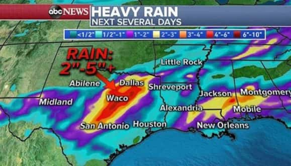
As much as 2 to 5 inches of rain could fall over the next several days in central Texas.
In addition to the severe storms in Texas and the Gulf Coast, heavy rain expected over the next two days.
Some areas could see an additional 2 to 5 inches of rain in Texas and 2 to 3 inches of rain from Louisiana to Mississippi and Alabama. More flash flooding is possible Wednesday and into the next couple of days.
Copyright © 2019, ABC Radio. All rights reserved.