


A low-flying helicopter will survey the eastern half of Arkansas for the next few months.
The U.S. Geological Survey is using the helicopter to map parts of the Mississippi Alluvial Plain between Cape Girardeau, Mo., and New Orleans to acquire a more robust picture of aquifers in the area. Flights are expected to last about two months, depending on weather.
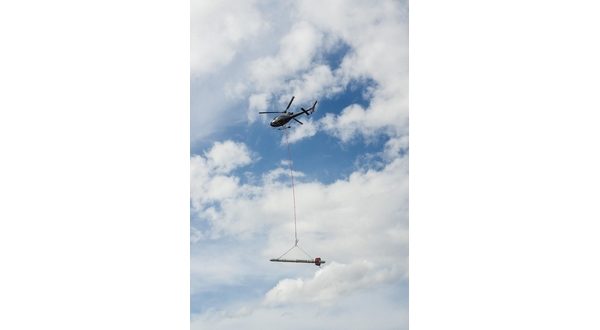
Experienced pilots who are specially trained and approved for low-level flying will operate the project’s helicopter. An attached electromagnetic instrument called a bird will be towed about 100 feet below the aircraft. The helicopter will also carry scientific instruments including a magnetometer and a gamma-ray spectrometer. None of the instruments pose a health risk to people or animals.
No flights are planned directly over the Twin Lakes Area, a map of the project’s flight paths indicate. The helicopter will scan parts of the White River between Batesville and Newport as part of the survey.
WebReadyTM Powered by WireReady® NSI