


Image courtesy of National Weather Service
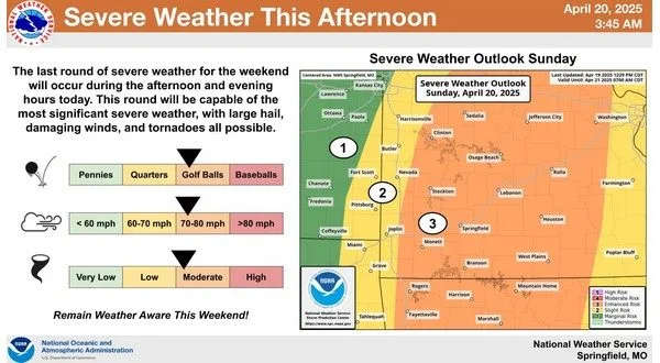
The severe weather possibility continues for the Twin Lakes Area and may be greater Sunday than it was Saturday. There is a severe thunderstorm watch in effect for Ozark, Taney and Douglas counties in southern Missouri until 8 Sunday morning.
Meteorologist Willie Gilmore of the National Weather Service office in North Little Rock says the biggest threat will start in the afternoon or early evening.
Listen:
A flood watch also remains in effect for the entire Twin Lakes Area through Sunday evening. Gilmore says the rainfall has had the biggest impact further west, but the area should see more precipitation Sunday.
Listen:
Tune in to KTLO, Classic Hits 101.7 and 99.7 The Boot for the latest severe weather coverage.
WebReadyTM Powered by WireReady® NSI