


Thursday’s forecasted rain chances continue to be lowered meaning dry conditions in the Twin Lakes area are likely to continue.
Over the last 40 days North Central Arkansas has received just over half an inch of precipitation leaving the area in a state of severe drought according to the U.S. Drought Monitor. December already ranked as the 6th driest on record with only 0.56 inches of rain recorded which falls far below the 3 inches the area usually sees during the last month of the year.
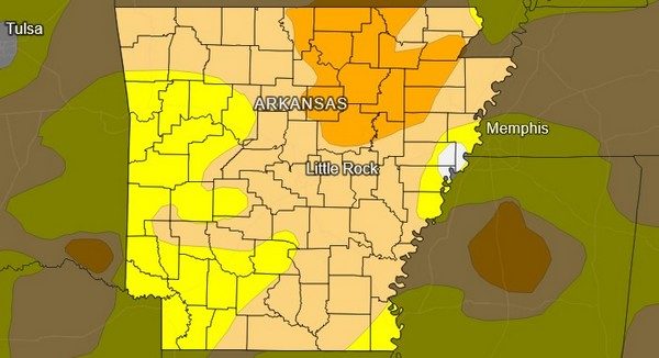
U.S. Drought Monitor shows severe drought over Twin Lakes area
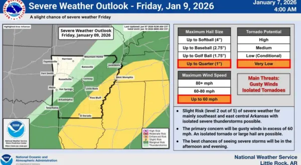
Rain is forecasted to fall across the area as a strong system passes through Thursday but as National Weather Service meteorologist Joe Goudsward states it may be less than originally hoped for.
Listen:
The system will move through the area starting Thursday afternoon with a slight chance of severe weather although the primary threat may be strong winds up to 60 miles per hour. Colder weather is expected to rally behind the system bringing temperatures closer to average for this time of the year.
Listen:
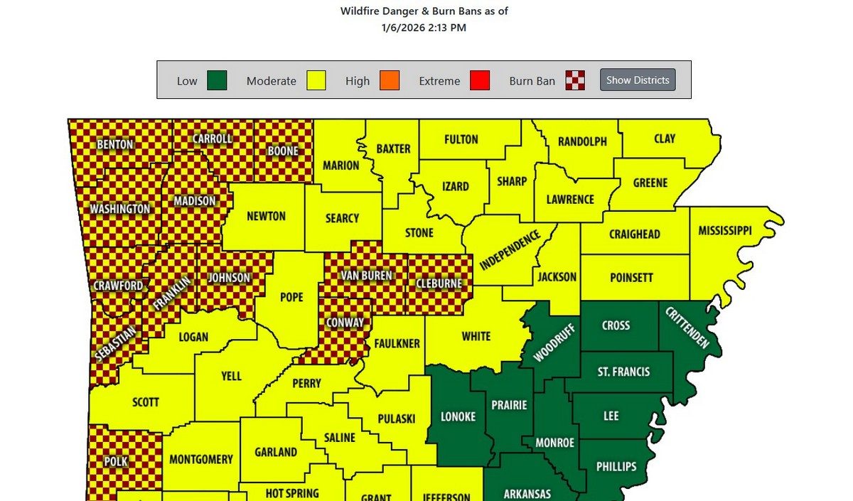
With clear conditions forecasted into the middle of January burn bans in the North Western portion of the state remain in effect until significant precipitation returns to the area.
WebReadyTM Powered by WireReady® NSI