


As the winter storm everyone has been talking about all week gets closer to the Twin Lakes Area, the amount of snow we are expected to get keeps going up. Thomas Jones with the National Weather Service in North Little Rock has the latest update for us.
The snow amounts will be lighter to the north of the Twin Lakes Area. To the south, snow amounts will also be lower, but there will be more sleet and freezing rain, especially through central Arkansas.
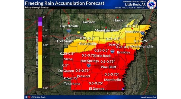
Jones says the wintery precipitation should begin Friday evening.
Once the snow moves out, we will see bitterly cold temperatures.
A winter storm watch is in effect for all of northern Arkansas and southern Missouri Friday night and Saturday.
You can get the latest weather information at ktlo.com/weather. For cancellations and road conditions, visit ktlo.com/cancellations.
WebReadyTM Powered by WireReady®NSI