


Heavy rain is falling Friday morning across the Twin Lakes area as the National Weather Service (NWS) is predicting an active weekend across the region with a strong focus on severe weather Monday.
KTLO, Classic Hits and The Boot News spoke with NWS Meteorologist Colby Pope who said after rains Friday, Saturday should be clear with comfortable temperatures.
Listen:
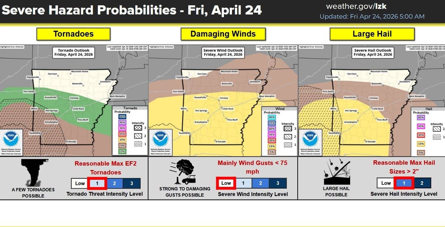
Friday’s expected chance for severe weather remains low at a reading of 1 out of 5 on the NWS scale of severe weather. Heavy rains will continue through the early part of the day with an inch of rain already observed at KTLO around 6 Friday morning. South of the Twin Lakes area into central Arkansas the severe weather increases where strong winds, large hail and a low chance of tornado activity is possible.
No tornadoes are expected Saturday across the state but the chance for strong winds and hail will remain mainly in the evening hours heading into Sunday.
Multiple rounds of strong to severe thunderstorms will be possible Sunday morning into the afternoon hours with the primary threat stronger in North Western Arkansas.
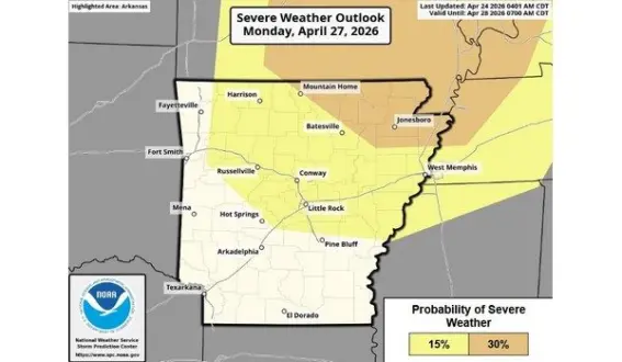
Monday afternoon into evening is showing signs of developing severe weather with Mountain Home at a risk level of 3 out of 5. All forms of severe weather is possible but uncertainty remains as forecasters work to tighten up details.
Stay tuned to KTLO, Classic Hits and The Boot on air and online at KTLO.com for the latest in severe weather updates.
WebReadyTM Powered by WireReady® NSI