


A lot of snow lovers are excited about the forecast for later this week, but many area fire departments are especially excited for any kind of precipitation to help quell the many brush and grass fires they have battled recently. The area continues to deal with very dry conditions and the latest U.S. Drought Monitor map released last Thursday shows a large area of north central Arkansas has moved into the extreme drought category, the fourth highest category out of five on the scale.
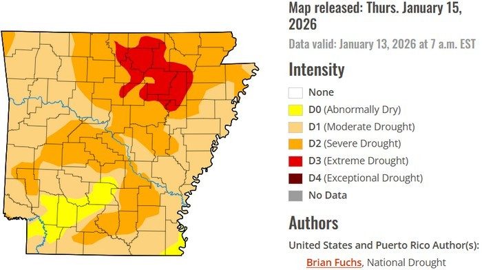
The extreme drought overlay encompasses all of Izard County, the southeastern half of Baxter County, the southeastern half of Fulton County and the northeastern half of Stone County.
The rest of Baxter, Fulton and Stone counties, along with all of Marion and Searcy, most of Boone and the eastern half of Newton County are listed in the severe drought category.
The far western part of Boone County and the western half of Newton County are in the moderate drought category.
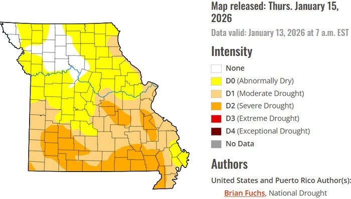
Across south central Missouri, most of the southern two-thirds of Ozark County, nearly all of Taney County, the southern two thirds of Howell County and the northwestern quarter of Douglas County are in the severe drought category.
The northern third of Ozark and Howell counties and the southeastern three-quarters of Douglas County show up in the moderate drought category.
In northern Arkansas, burn bans are in effect for Fulton, Izard, Stone, Searcy and Boone counties until significant rainfall occurs.
The Arkansas Forestry Division lists all of Arkansas in the moderate category for wildfire danger.
WebReadyTM Powered by WireReady® NSI