


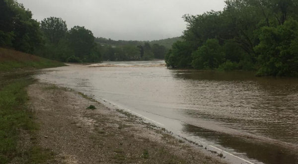
(photo courtesy of Ozark County Times)
The rainfall over the weekend caused severe damage in Ozark County, especially along the North Fork of the White River which set a new record crest but we may never now how high the river got. The last reading the gauge at Tecumseh took was at 9:45 Saturday night but before another reading could be taken, the gauge broke.
At the time of the last reading the gauge took Saturday night, the river hit a new record high of 35.51 feet which eclipsed the old record of 35 feet which had stood for over a century. The old record was 35 feet set in 1915. The National Weather Service had said in their flood warning for the river they expected it to crest at 40 feet early Sunday morning.
The river’s normal level runs between four and six feet.
According to the National Weather Service, there could be several reasons why they never got another reading. They said sometimes gauges go out because they get submerged, the satellite transmitter could be underwater, or it can be that water got into the equipment. Or it could be more serious and the equipment can be damaged which is highly possible considering the amount of large debris that was in the water Saturday night.
A team from the United States Geological Survey agency is expected to conduct a survey of the river in the coming weeks to see if they can determine what the true crest was.
WebReadyTM Powered by WireReady® NSI