


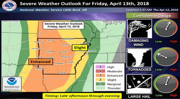
A cold front will surge across from the northwest on Friday beginning at approximately 4:00 in the afternoon and continuing into Saturday. Ahead of the front, severe thunderstorms are expected in the Twin Lakes Area. Heavy rainfall is possible, particularly between the times of 7:00 to 10:00 Friday night.
Heather Cross, meteorologist from the National Weather Service in North Little Rock, has a summary.
Listen:
The front will push through to eastern Arkansas Saturday morning bringing the storms to an end. Behind the cold front there will be cooler temperatures. We can expect the thermometer to dip to near freezing Sunday morning and temperatures below freezing Monday morning.
WebReadyTM Powered by WireReady® NSI