


The National Weather Service in North Little Rock expects that scattered to isolated showers will continue to move over Arkansas early this afternoon through early this evening. Widespread rain showers with isolated thunderstorms are expected to spread across the state later this evening through the overnight hours.
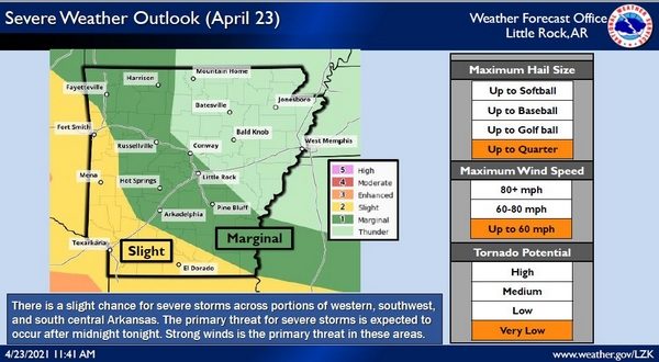
After midnight tonight, a strong squall line of storms is expected to move from eastern Oklahoma into western Arkansas. This line of storms is expected to weaken as it enters the state, but may maintain some strength across portions of southwest and south central Arkansas.
Strong and damaging winds will be the primary concern with the stronger portion of the line, with gusty, but non-damaging winds expected across the remainder of the state.
Rainfall amounts of one inch to one-and-a-half inches are forecast over much of the state. Isolated higher amounts are possible where thunderstorms become embedded in the widespread rain shower activity.
Another storm system is expected to move across Arkansas in the middle of the week ahead, bringing a potential for some heavy rainfall across the state. This second system may bring 2 to 3 inches of rain across the state, bringing the state’s seven-day rainfall forecast totals up into the 3-6 inch range. Flooding is not a significant concern at this time, as many locations across Arkansas are below normal for rainfall at this time.
WebReadyTM Powered by WireReady® NSI