


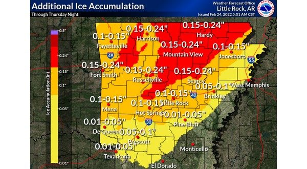
After sleet, freezing rain and light snow fell across the Twin Lakes Area Wednesday, more wintry precipitation is expected Thursday. More light freezing rain fell in the area Wednesday night, creating a glaze of ice on top of the sleet that fell earlier in the day.
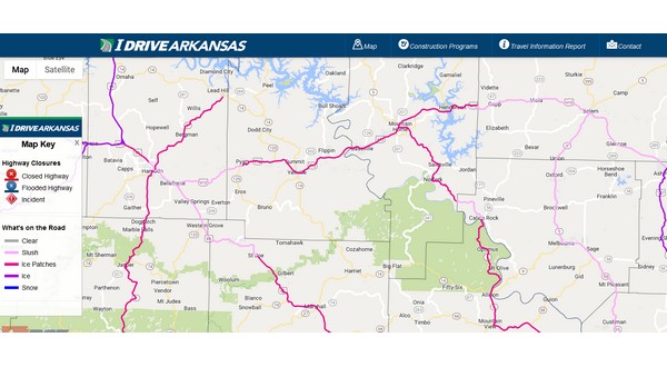
Main highways in the area have patchy ice or slush, but side roads and parking lots are ice covered. The Arkansas Department of Transportation’s idrivearkansas.com website shows most highways in Baxter, Marion, Stone, Searcy, Boone and Newton counties have ice patches. Highways in Fulton and Izard counties are reported to have slush.
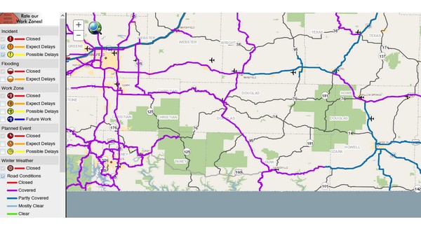
The Missouri Department of Transportation’s road maps at traveler.modot.org show highways in Ozark, Douglas and Taney counties are covered, while Howell County highways are mostly partly covered.
Those road conditions are expected to change later Wednesday, as round two of wintry precipitation moves in and is expected to be mainly freezing rain, according to meteorologist Thomas Jones with the National Weather Service in North Little Rock.
Listen:
Jones says the freezing rain will cause more problems for the area.
Listen:
A winter storm warning is in effect for northern Arkansas until 6 Thursday evening and until 9 Thursday night for southern Missouri.
You can get the latest cancellations at ktlo.com/cancellations brought to you by Baxter Regional Medical Center.
WebReadyTM Powered by WireReady® NSI