


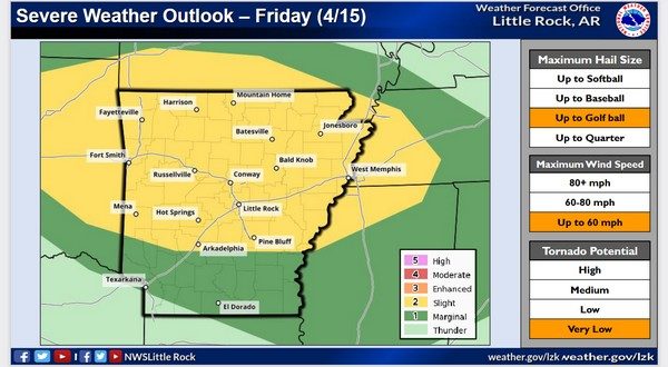
Another round of severe weather is possible Friday night, and it could bring in more heavy rains to the Twin Lakes Area. A severe thunderstorm watch is in effect for the entire area until 10 Friday evening, and a flood watch will be in effect for Baxter, Marion, Searcy, Stone, Boone and Newton counties in North Central Arkansas from 7 Friday evening through Saturday afternoon.
Meterologist Tabitha Clark from the National Weather Service office in North Little Rock says showers are currently in development in the southwestern portions of Missouri.
Listen:
Clark says the main threats will be wind and hail. The possibility of an isolated tornado is low but can’t be ruled out.
Tune in to KTLO, Classic Hits and The Boot for severe weather coverage.
WebReadyTM Powered by WireReady® NSI