


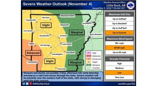
A cold front will move through the state Friday, bringing with it a chance of severe weather between the afternoon and Saturday morning.
According to the National Weather Service out of Little Rock, a cold front will approach Arkansas from the west with developing showers and thunderstorms reaching the Oklahoma-Arkansas border Friday afternoon. Storms will begin to form across far western Arkansas as a line, with the possibility of a few supercell thunderstorms ahead of it. The main threats are severe damaging winds, isolated tornadoes, and heavy rainfall that could lead to localized flash flooding.
Storms are expected to reach the listening area around 5 o’clock.
Stay tuned to KTLO, Classic Hits and The Boots as severe weather continues to develop.
WebReadyTM Powered by WireReady® NSI