


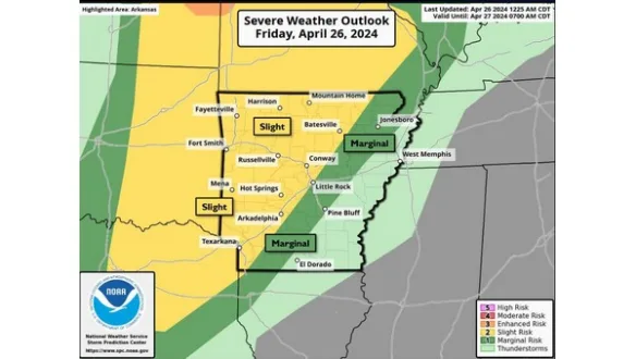
A warm and moisture-rich atmosphere Friday will lead to the potential for strong to severe thunderstorms to develop and move into the Twin Lakes area during the evening hours. Current models have a window between 7 and 10 Friday night showing a line of storms moving across the state with all modes of severe weather being possible including large hail, damaging wind gusts, and a few tornadoes. The greatest risk of severe weather appears to be located in western portions of the state while central portions are less likely to be impacted.
National Weather Service meteorologist, Eric Greene shares the following Friday morning weather update.
Listen:
With multiple storm systems expected to impact Arkansas through the weekend be sure to stay tuned to KTLO, Classic Hits and The Boot for the latest weather updates.
WebReadyTM Powered by WireReady® NSI