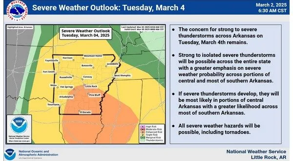
KTLO News spoke with National Weather Service meteorologist Colby Pope Monday morning about an approaching weather system expected to bring storms and strong winds to the Twin Lakes area on Tuesday.
“The real big story is going to be during the day on Tuesday, and that’s when we could see some showers and thunderstorms across the listening area, particularly around the noontime hour on Tuesday into the early afternoon time frame,” Pope said.
A line of storms will move west to east across the state, though Pope noted that instability levels remain uncertain. “We’re really questioning the ability for some of these to really have the instability necessary to really maintain themselves as far as being very severe,” he said. While some storms could become strong, the primary concern will be wind gusts in excess of 60 miles per hour.
Pope also mentioned that while an isolated tornado “can’t completely be ruled out,” the greater risk for severe storms will be further south. “Right now, it’s looking like the greater risk for instability and the greater risk for severe weather is going to be across central and southern portions of the state,” he explained.
After the storms pass, strong winds will persist from Tuesday evening through Wednesday evening. “We will see some really gusty winds, which will be sustained winds of 20 to 25 miles per hour, and with gusts as high as 45 possibly 50 miles per hour,” Pope said.
Stay tuned to KTLO, Classic Hits and the Boot for the latest in weather coverage. The forecast for the rest of the week shows mostly sunny conditions with highs ranging from the mid 50s to the mid 60s.
WebReadyTM Powered by WireReady® NSI


