


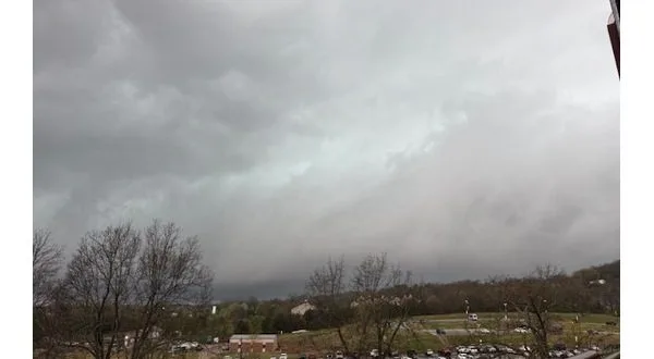
Photo taken from atop Baxter Health shows storm crossing over Mountain Home.
An active afternoon in the Twin Lakes area brought all modes of severe weather, including tornado warnings, hail, and heavy rain, as residents now prepare for historic rainfall in the coming days.
Storms began to intensify around 2. Severe thunderstorms were quickly upgraded to multiple tornado warnings as storms moving out of Newton County barreled into Marion and Baxter counties. Local schools were placed on storm lockdowns, and students were moved into shelters as the storms passed. As the system moved out of the Yellville area toward Mountain Home, large hail was reported in Summit, and straight-line winds were reported across the region. The all-clear for Mountain Home and the eastern half of Baxter County was issued shortly before 3 as the system continued northeast toward the state line and the already storm-damaged community of Bakersfield, Missouri. At this time, there have been no confirmed reports of a tornado touching down in the area.

Annie Allen in Summit shows off large hail stones from afternoon storms
KTLO News spoke with Baxter County OEM David Stults, who said that as of 4, there were no major reports of storm damage. Marion County OEM Melissa Penn echoed the same, reporting no major damage but confirming reports of golf ball-sized hail.
Flash flood warnings have been issued for portions of the listening area as strong downpours hit this afternoon, with 1.78 inches of rain recorded at the KTLO, Classic Hits, and The Boot studios on Highway 5 North in Mountain Home.
Attention now turns to multiple rounds of heavy rain expected in the coming days. A flash flood watch is in effect until Sunday morning, with projected rainfall totals of 8 to 10 inches. Heavy pockets of rain could lead to localized flooding, with some areas seeing up to 14 inches. The National Weather Service has stressed that some locations could experience historic rainfall levels not seen in the past 50 to 100 years.
Stay tuned to KTLO, Classic Hits and The Boot News for the latest severe weather coverage in the coming days.
WebReadyTM Powered by WireReady® NSI