


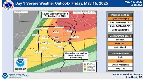
An enhanced risk of severe storms is possible for Friday according to the latest release from the National Weather Service (NWS) in North Little Rock. As of Friday morning storms are expected to impact the Twin Lakes area in the afternoon hours with chances of storms dissipating by early evening.
All severe weather hazards will be possible with the primary threats being strong winds, softball sized hail and possibly tornadoes. Mostly sunny conditions early will see warm and humid conditions with highs expected in the upper 80s. Storms that develop first will be isolated and as they move east, the threat of severity will increase.
Storm chances will continue daily into early next week with mid week seeing cooler and more stable conditions.
Stay tuned to KTLO, Classic Hits and The Boot for the latest in severe weather coverage.
WebReadyTM Powered by WireReady® NSI