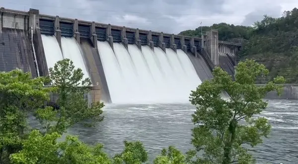
The Corp kept up efforts all month letting water out of area lakes after heavy spring rains
Besides one record breaking rainfall day the month of July ended lower for precipitation compared to the past three years in the Twin Lakes Area with temperatures hovering around average.
After a very wet spring season, in which the area broke the record for total rain ever recorded in a six month period, the month of July ended with a total of 5.06 inches of precipitation recorded at KTLO, Classic Hits and The Boot, the official reporting station for the National Weather Service in Mountain Home. July 15 saw heavy ran as 3.32 inches of rain was recorded, breaking the previous record set on July 14, 1925 of 2.0 inches. Due to the saturated ground and continued threat of heavy rain, the National Weather Service had issued a Flood Watch for the area that day. Most of the month was actually dry with 26 days out of 31 recording no rain.
Compared to 2024 and 2023, 2025 ended lower for rain in July. 9.64 inches and 7.28 inches of rain where recorded in 2023 and 2024 respectively compared to this year’s 5.06 inches.
Temperatures stayed close to average for the summer month with the hottest day being the 30th with a high of 97 degrees. The coolest high was the day of the big rain on the 15th with the high only reaching 81. The coolest temperature recorded was a low of 68 degrees on the 2nd and 3rd. Average high for the month was 90 and average low was 71.
The Twin Lakes area is approaching the tipping point for average temperatures as August begins. Traditionally after the middle of the month temperatures begin to slowly make the trend downward as the calendar continues to move towards the fall. Long term forecasting shows the southern region of the country is expected to see slightly higher than average temperatures in August with slightly below average precipitation expected.
WebReadyTM Powered by WireReady® NSI


